Where travel agents earn, learn and save!
Travel & Selling Tips / Hidden Hikes: The Camino de Costa Rica
Costa Rica is seeing a rise in visitors looking to participate in authentic cultural activities outside the main tourist hotspots
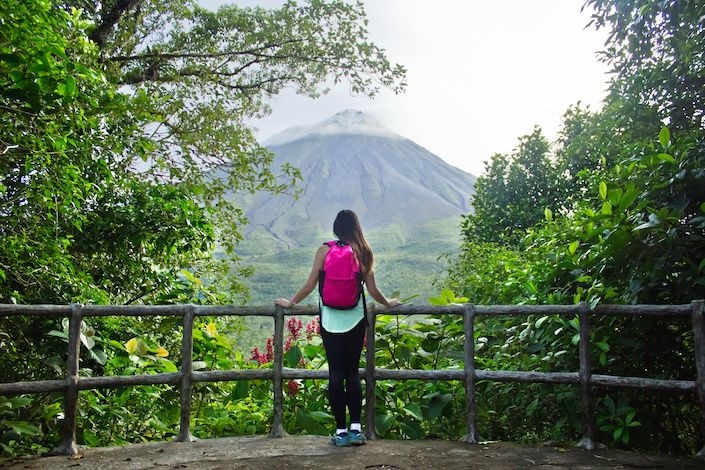
Costa Rica may be known for its tropical rainforests, colourful wildlife and lush beaches, but amongst the many natural resources is an exciting initiative that aims to provide avid hikers and explorers with a rural tourism experience that showcases the mountains, forests, valleys and communities of little-known corners of the country. Travellers can do what they love when hiking the Camino de Costa Rica, which stretches from the Caribbean sea to the Pacific Ocean, whilst at the same time supporting local artisans and tour guides, and spreading their tourism dollar amongst local communities.
Costa Rica is seeing a rise in visitors looking to participate in authentic cultural activities outside the main tourist hotspots, where they can distribute their hard-earned dollars within small communities whose residents invite them to share in their activities, traditions, and storytelling. And often, their homes.
For the active traveller, the Camino de Costa Rica route allows for unique experiences that combine rural, community focused tourism alongside traversing lush, natural landscapes. Whether it’s an avid hiker seeking new challenges, or a nature enthusiast eager to explore Costa Rica’s untamed beauty, this trail offers it all.
Here are some highlights from various points of the route, bound to appeal to hikers everywhere.
Stages 3 & 4 - Indigenous Zones
At this point of the Camino de Costa Rica, hikers get to experience the unique sights and sounds of the Costa Rican jungle which has been protected for generations by local indigenous communities. It’s at this stage in the journey that travellers will be accompanied by a Cabecar indigenous guide, who explains the connection to the land, how the tribes use flora and fauna in their daily lives, and shares stories of the area.
Stage 5 - Walk the Mountain Range
During this stage of the trek, travellers walk along the top of the Talamanca Mountain range, with spectacular views on a clear day of the Caribbean plains. Small sugar cane mills can be found in the area, with many sugar cane fields found in the Turrialba Valley below.
Stage 10 - The Cloud Forest
The route beginning in Navarro de Muñeco sees travellers make a 2km hike towards the Palo Verde Cloud Forest, where a further 6km are traversed amidst the primary forest. The walk is surrounded by the song of the Bell Bird and other avian friends, and travellers should keep an eye out for the resplendent Quetzal during this stage.
Stage 12 - Sweeping views
For stage 12, the day’s hike starts at the Jardín de Dota junction and passes by an old abandoned pit in Cerro la Roca before continuing on to Cerro la Trinidad. If the weather allows, hikers can make the ascent to the summit of Cerro Trinidad to see stunning vistas of the towns of San Marcos and San Pablo.
Stage 16 - The Pacific Ocean
The final leg of the Camino de Costa Rica starts in the town of Villa Nueva, before heading towards the Quepos boardwalk, where the pacific ocean welcomes weary walkers with its cool waves and picturesque beaches. It’s at this point travellers can say they have traversed the country from coast to coast and hiked 280km, a very admirable feat.
Whilst the Camino de Costa Rica is suitable for different levels of hikers, it is suggested that hikers with less experience take their time and choose a longer duration. Customised itineraries to include individual portions of the route can also be developed in co-ordination with specialist hiking companies in the country such as Urri Trek and Ticos a Pata.
Below are some key facts about the route:
At a glance:
- 280 km across Costa Rica, from Caribbean to Pacific oceans
- Hikers must be able to walk 15km easily and bring adequate equipment
- The route has 16 sections
Starts: Parismina or Barra del Pacuare, Limon Province
Ends: Quepos, Puntarenas Province
These are the suggested time frames dependent on hiking ability:
- 11 Days for advanced hikers
- 14 Days for intermediate hikers
- 16 Days for moderate hikers


